


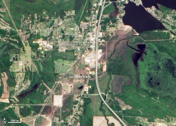
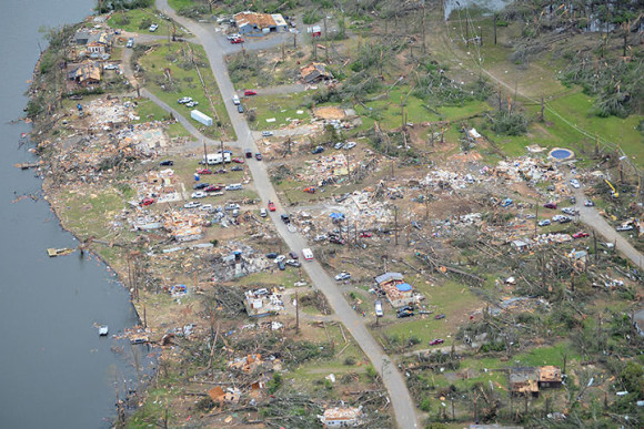
In late April, 2014, a severe weather system descended on the U.S. Central Plains, fueling intense thunderstorms and tornados. Among the hardest hit areas were the small towns of Mayflower and Vilonia, Arkansas. Sixteen people were killed and 400 to 500 homes were destroyed.
A few days later, NASA’s Aqua satellite saw clear evidence of the damage in the form of a brown trail – what scientists call a tornado track – across the otherwise green landscape in Mayflower. NASA’s Advanced Land Imager (ALI) on Earth Observing-1 (EO-1) satellite captured this iamage on May 2.
Read more at NASA Earth Observatory
Like what you read?
Subscribe and receive daily news delivered to your inbox.
Thank you! Your submission has been received!
Oops! Something went wrong while submitting the form.
More from
Deborah Byrd
View All


Meet Gaia BH3, our galaxy’s most massive stellar black hole
April 17, 2024
Hercules is between 2 bright stars: Vega and Arcturus
April 17, 2024
Mars in 2024: It’s found in the morning sky
April 10, 2024


