


Watch EarthSky’s Kelly Kizer Whitt hike to the dinosaur tracks in Ouray, Colorado.
Dinosaur tracks now part of national forest
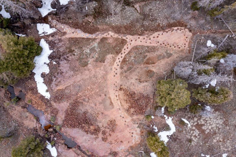
Some 150 million years ago, a long-necked dinosaur known as a sauropod took 134 steps that are now etched across a landscape in Colorado. The dinosaur made a loop, tracking back over its prints as if it had taken a look at where it was headed and then changed its mind. Today, these tracks are the longest-known continuous sequence of sauropod footprints in the world. And on April 10, 2024, the Grand Mesa, Uncompahgre and Gunnison National Forests acquired 26 acres (10.5 hectares) in Ouray County, Colorado, containing these footprints.
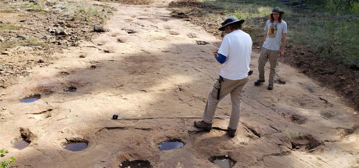
The land containing the footprints had belonged to the Charles family since 1945. Members of the Charles family prospected for gold in the hills and played among the “potholes,” which, they said, were favorite locations for their dogs to explore. In 2021, the family discovered those “potholes” were really dinosaur footprints. The following year, the Charles family asked the U.S. Forest Service if they would be interested in the land. Anita McDonald, a trustee for the family estate, said:
The family is happy to offer this unique trackway to the U.S. Forest Service, ensuring that the land is protected and enjoyed by future generations.
The tracks are rare
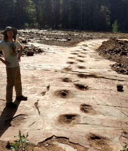
The deep tracks allow scientists to measure the dinosaur’s steps and stride. From the steps, it appears the dinosaur was heading north and then made a sharp loop to cross its own tracks and continue on. An international team of researchers who studied the tracks said:
Trackways attributable to turning dinosaurs are relatively rare, with only six sauropodan examples known from five sites.
Another unusual feature of this site is that glaciers have scoured the landscape, yet the dinosaur tracks persisted. The individual tracks are even large enough that they’re visible on Google Earth images.
Of course, the researchers have cleared the site for study, making them even easier to see from space.
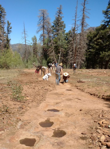
Hike to the dinosaur tracks
Often, locations of dinosaur tracks and other precious heritage remains a secret to preserve the integrity of the finding. But these deep tracks are set in extremely resistant rock and well “off the beaten path,” as the researchers described. Therefore, the potential for damage is quite low, and the site is open to the public, if you’re willing to make the climb.
The dino tracks are west of the little city of Ouray, Colorado. It’s a steep climb up the Silvershield Trail to the 9,300-foot-elevation site. To get there, you’ll need to hike up two miles one way. And don’t forget your bear spray.
Check out the Silvershield Trail on AllTrails.
Bottom line: Dinosaur tracks from 150 million years ago remain preserved at high altitudes outside Ouray, Colorado. Now they’re on public lands, and you can visit!
Like what you read?
Subscribe and receive daily news delivered to your inbox.
More from
Kelly Kizer Whitt


