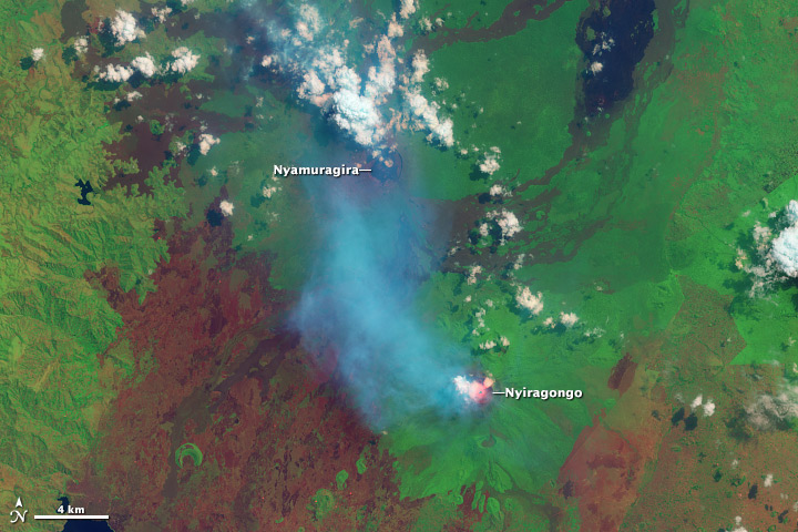
Check out this image of volcanic plumes streaming from the Nyamuragira and Nyiragongo volcanoes. This image was collected by NASA’s Landsat satellite on July 29.
Located in the Democratic Republic of the Congo near the border with Rwanda and Uganda, the volcanoes are among the most active on Earth.

Here’s the NASA description of the image:
Nyiragongo features a persistent lava lake, revealed by the red glow of shortwave infrared* light. A translucent blue volcanic plume stretches north from Nyiragongo, partially shrouding Nyamuragira. The plume from Nyamuragira is dense and white, suggesting the presence of large amounts of water vapor. The landscape is a mixture of forest (bright green), cleared areas (red-brown), and old lava flows (various shades of black, brown, and green, depending on their age and the amount of vegetation growing on them).
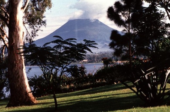
Here’s a photo of Nyiragongo from the ground:

*Shortwave infrared is between near infrared light (seen in infrared photography) and thermal infrared light (used by temperature sensors) on the electromagnetic spectrum. Shortwave infrared light is reflected by some surfaces (like bare soil), and emitted by very hot objects (lava or fires).
Bottom line: Plumes of water vapor, sulfur dioxide, carbon dioxide, fluorine, and chlorine gas escape from Africa’s Nyamuragira and Nyiragongo volcanoes in this NASA Landsat satellite image, collected on June 29, 2013.


