


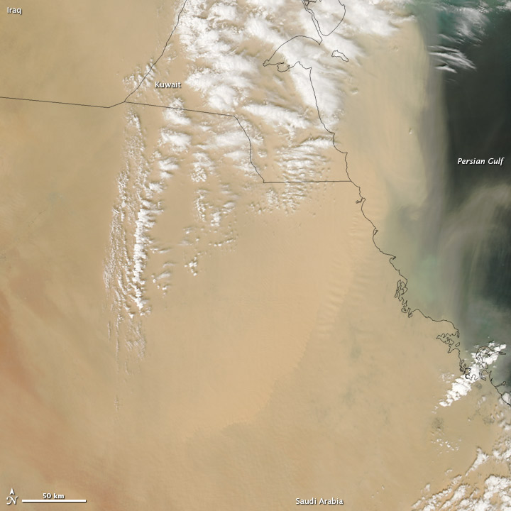
NASA’s Aqua satellite acquired this natural-color image of a thick veil of dust spanning hundreds of kilometers over parts of the Arabian Peninsula and the Persian Gulf on April 5, 2013. Clouds hovered over the dust, especially over Kuwait. According to NASA’s Earth Observatory, which published this image earlier today, dust storms are frequent natural hazards for Iraq, Kuwait, and Saudi Arabia due to fine sediments from dry riverbeds and lakebeds, and sand seas. They said that, today, clouds might have been associated with a weather front stirred the dust.
Bottom line: Image from NASA’s Aqua satellite showing dust over the Arabian Peninsula on April 5, 2013.
Like what you read?
Subscribe and receive daily news delivered to your inbox.
Thank you! Your submission has been received!
Oops! Something went wrong while submitting the form.
More from
Deborah Byrd
View All


How to watch a solar eclipse safely on April 8
April 1, 2024
Notice the westward shift of Orion and all the stars
March 25, 2024
March equinox 2024: All you need to know
March 19, 2024


