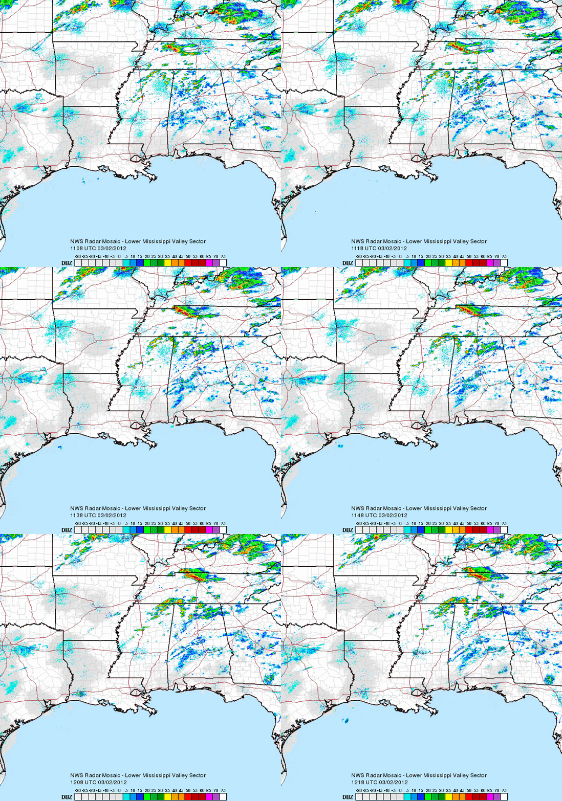
In my previous post on EarthSky, I mentioned the chances for severe for this upcoming weekend. I mentioned how the storms that develop on March 2-3, 2012 will be more potent than the storms that pushed through February 28 and 29, 2012. There is an elevated risk for strong, long lived tornadoes across central Tennessee and Kentucky. Strong tornadoes cannot be ruled out across northern Mississippi, central and northern Alabama, and across the Ohio River Valley. These storms will be capable of producing large hail, strong winds over 60 miles per hour, and frequent cloud to ground lightning. In this post, I am going to explain the ingredients that are coming together to see a significant severe weather outbreak. I will also have a few safety rules at the end that you and your family can follow in case a severe storm moves through your area.
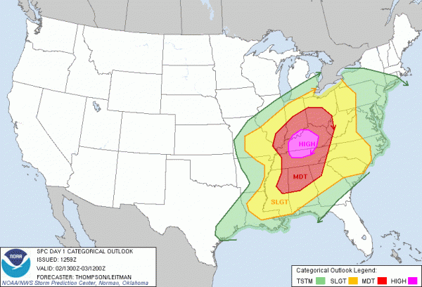
The Storm Prediction Center, also called the SPC, is an office that predicts and outlooks severe weather across the United States. The “risk” areas are just one of many products they create that outline the risks of severe weather across the nation.
Here is the outlook for today’s severe weather. High risk areas are extremely rare and are typically issued once or twice a year. This is a very serious situation for Kentucky and north/central Tennessee:

Here’s the threat for tornadoes:

In this image, the numbers/percentages show the probability of a tornado within 25 miles of a point. Areas that are hatched show a 10% or greater probability of EF2 – EF5 tornadoes within 25 miles of a point. A 30% hatched area is VERY significant!!!!
Here’s the wind threat:

In this image, the percentages represent the probability of damaging thunderstorm winds or wind gusts of 50 knots (60 mph) or higher within 25 miles of a point. The hatched area shows a 10% or greater probability of wind gusts 65 knots (75 mph or hurricane force) or greater within 25 miles of a point.
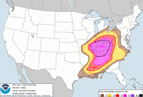
Here’s the hail threat:

In this image, the percentages represent the probability of one inch diameter hail or larger within 25 miles of a point. The hatched area shows a 10% or greater probability of two inch diameter hail or larger within 25 miles of a point.

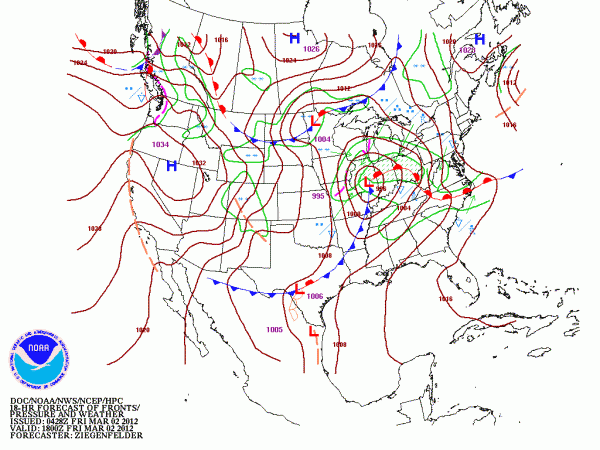
A strong area of low pressure will develop and move northeast. Behind this front, temperatures are very cold with highs expected to climb in the 40’s across Missouri and Iowa. South and ahead of the front, unusual warm air for this time of year will provide the trigger to see severe thunderstorms capable of producing strong tornadoes. Wind shear is very high, which contributes to sustaining thunderstorms. Helicity levels, or the spin in the atmosphere is very high too. High helicity values indicate areas of strong tornado development. Instability, which measures how stable the atmosphere becomes, is very high for this time of year across the risk areas. Areas could exceed 2000 joules per kilogram, which is fairly high. There will be plenty of moisture to work with, so all of the ingredients are being put together for a significant outbreak of severe storms and tornadoes.
The STP, or Significant tornado parameter measures all of the above ingredients mentioned above and puts out areas likely to see signifcant tornadoes. Anything over a 1 is considered significant.
Here’s strong wording from the National Weather Service in Nashville, TN. NOTE: The SEC Tournament in women’s basketball is being played today. This makes me nervous. Reminds me of the SEC Men’s Tournament in Atlanta back in 2008 when the Atlanta tornado pushed through:
A BIG SEVERE WX OUTBREAK IS EXPECTED FOR MID TN
FRIDAY. STRONG LONG TRACK TORNADOES…DAMAGING WINDS AND LARGE
HAIL ARE ALL POSSIBLE. SPC CONTINUES TO POST A MODERATE RISK FOR
SEVERE WEATHER OVER THE MID STATE. THIS EVENT LOOKS MORE
WIDESPREAD AND SUBSTANTIAL THAN THE SEVERE THREAT WE HAD
YESTERDAY…PROBABLY THE BIGGEST OUTBREAK OF TORNADOES SINCE
APRIL 27, 2011. THIS EVENT COULD BE ONE OF THE GREATER IMPACT
EVENTS IN THE PAST FEW YEARS. THE PUBLIC SHOULD BE STRONGLY ADVISED
TO TAKE THIS THREAT VERY SERIOUSLY.
Because of such a high elevated threat, let’s have a quick review on safety:
Severe Weather Safety:
Here’s just general rules about severe weather safety. I will have a post early next week talking about weather safety in full detail.
General rules:
-Charge all electronics.
-Have a safety plan in place now. Know where your “safety” spot is located.
-Own a NOAA Weather Radio with fresh, new batteries. If you do not have one, you can download the iMap Weather Radio Application on your smartphone. It notifies you if severe weather is heading your way.
-Stay away from rooms in your house that are near large trees outside. Strong winds can bring trees crashing into your house.
-Avoid all travel during the times severe weather is likely.
Tornado rules:
-If a tornado warning is issued in your area, move into the lowest floor towards the centralized portion of your house away from doors and windows.
-If you own a bicycle/football helmet, wear it. A lot of injuries and deaths occur due to flying debris and trauma to the brain.
-If you do not have a basement, relocate into a bathroom or hallway.
-Grab a whistle and put it in your pocket. If a tornado does strike, and you are trapped in debris, a whistle can let people know you are trapped.
Summary: A significant weather outbreak is going to occur today with a high risk of severe storms for Kentucky and north/central Tennessee. Supercells and a line of embedded supercells and bowing segments are possible as the front pushes east. Anytime after 12pm will be prime for severe thunderstorms. Some tornadoes could be strong and long-lived. Instability and shear are increasing in these areas, which will only provide more juice for storms to produce strong winds and possibly violent tornadoes. Please be ready for this. I will not compare this event to other historical tornado outbreaks because they are all different. However, I will say this: This is a serious situation. Be weather ready NOW!


