Adam Voiland, a science writer for NASA’s Earth Observatory, said the idea came to him when he spotted a V in a smoke plume while working on a story about Canadian wildfires in 2012. With the help of readers and colleagues, Voiland tracked down images resembling all 26 letters of the English alphabet spelled out in Earth features using only NASA satellite imagery and astronaut photography. He said that some of the letters – like O and C – were easy to find, and others – A, B, and R in particular — were maddeningly difficult.
So this seems a fitting way to say HNY – Happy New Year – from EarthSky to our friends!
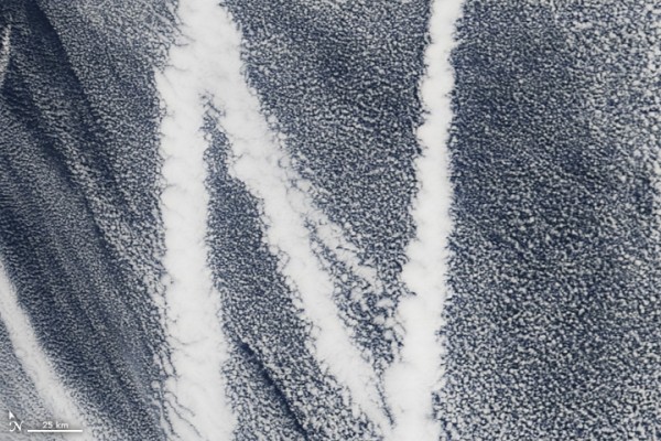
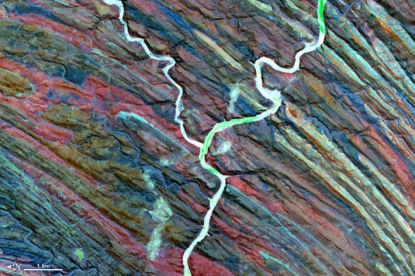
On August 30, 2014, the Operational Land Imager on Landsat 8 acquired this image of rivers running through colorful ridges in southwestern Kyrgyzstan. Image credit: NASAOn March 4, 2009, the Moderate Resolution Imaging Spectroradiometer (MODIS) on the Terra satellite captured this image of ship tracks over the Pacific. Ship emissions contain small particles that cause the clouds to form. Image credit: NASAOn December 25, 2000, by the Advanced Spaceborne Thermal Emission and Reflection Radiometer (ASTER) on NASA’s Terra satellite captured this false-color image of the Ugab River in Namibia. Image credit: NASA
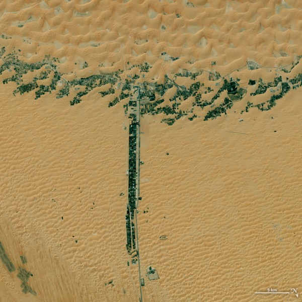
On August 14, 2015, the Operational Land Imager (OLI) on Landsat 8 captured this image of glaciers in the Tian Shan mountains in northeastern Kyrgyzstan. The trail of brown sediment in the middle of the uppermost glacier is a medial moraine, a term glaciologists use to describe sediment that accumulates in the middle of merging glaciers. Image credit: NASAOn March 9, 2015, the Operational Land Imager (OLI) on Landsat 8 captured this image of development along two roads in the United Arab Emirates. Image credit: NASA
Eleanor Imster has helped write and edit EarthSky since 1995. She was an integral part of the award-winning EarthSky radio series almost since it began until it ended in 2013. She and her husband live in Tennessee, where they enjoy guitar playing and singing. They have 2 grown sons.
Like what you read? Subscribe and receive daily news delivered to your inbox.
Thank you! Your submission has been received!
Oops! Something went wrong while submitting the form.